Throughout the nation’s history, Da Nang has been known not only as the largest seaport city in Central Vietnam but also as a landmark closely associated with the territorial expansion of Đại Việt over many centuries. This marks the beginning of Da Nang History as a crucial gateway and outpost in national defense.
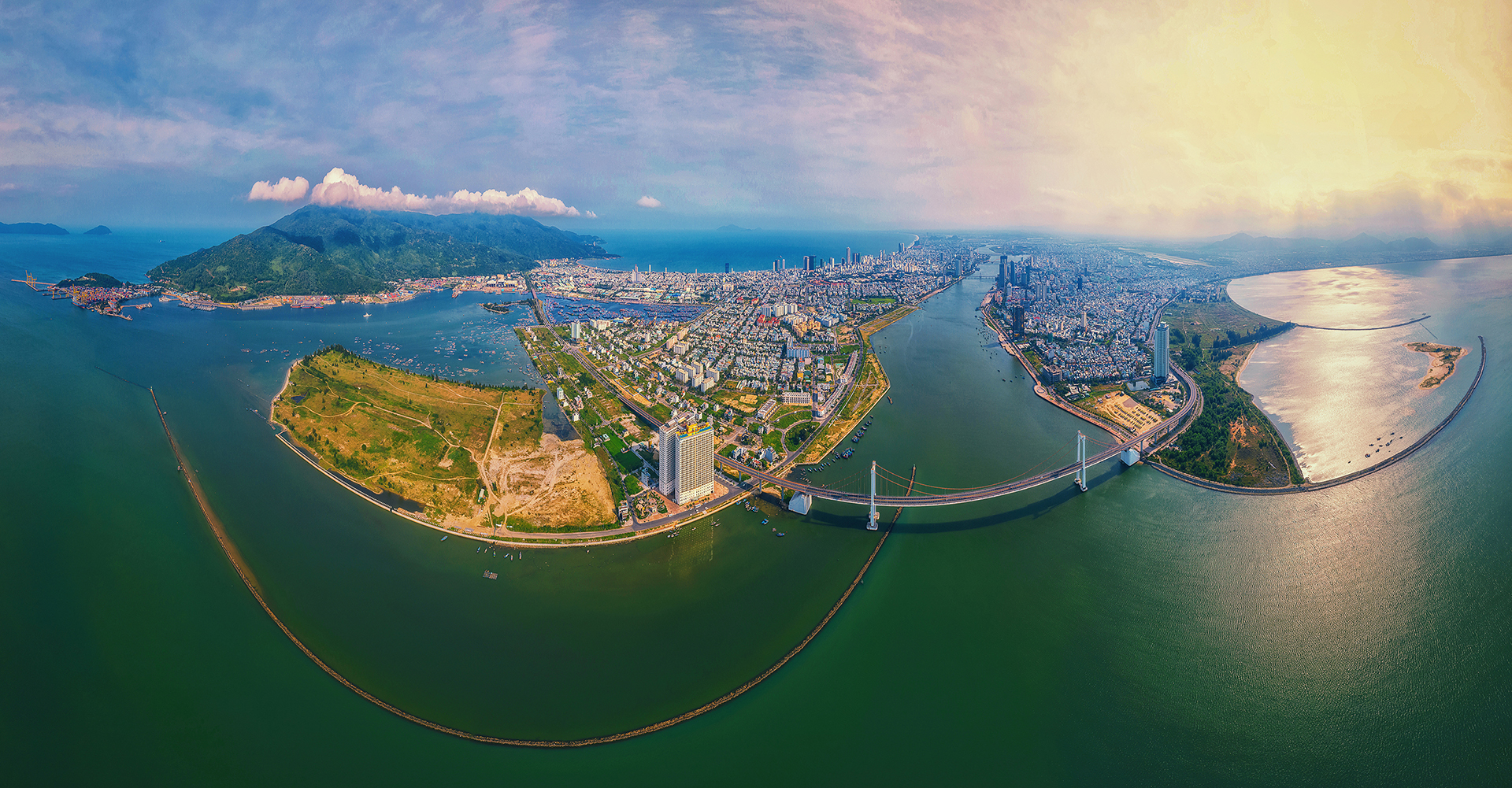
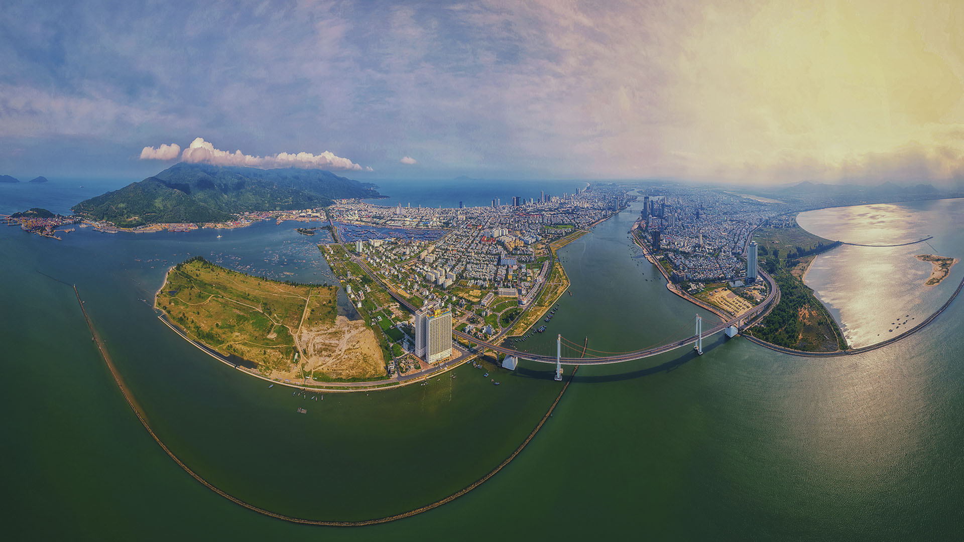
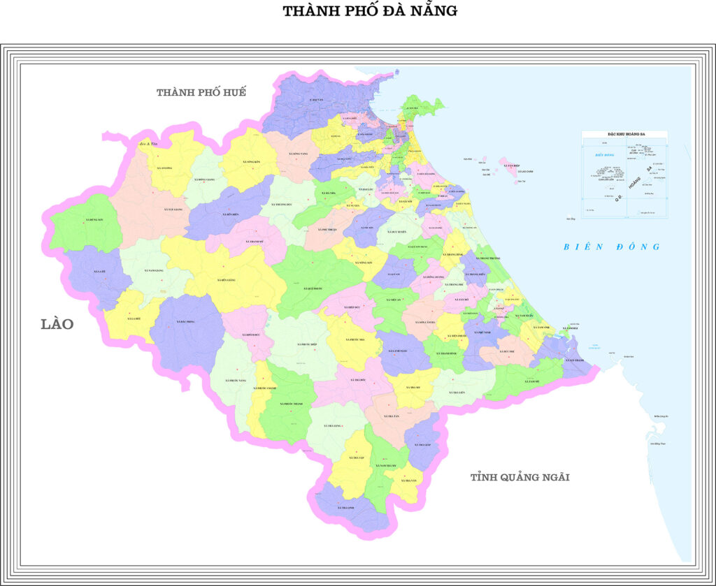
The newly established Da Nang City covers a natural area of 11,859.59 square kilometers and has a population of 3,065,628 people. It borders Hue City to the north, Quang Ngai Province to the south, the Lao People’s Democratic Republic to the west, and the East Sea to the east.
Da Nang is the locality with the largest area among the six centrally governed cities.
THE PLACE NAME DA NANG
According to the book “A Brief History of Da Nang: 700 Years (1306–2006)” – Da Nang Publishing House – by authors Lê Duy Anh and Lê Hoàng Vinh, the place has been commonly known by three names: Da Nang, Han, and Tourane.
- Da Nang: The name “Da Nang” is not of purely Vietnamese origin but derives from the Cham language (Chăm, Champa, or Chiêm Thành). In this context, “Đà” means river and “Nẵng” means great. Therefore, Da Nang translates as “Great River.”
- Han: If the person asked was Cham, the answer would be “Darak” or “Danak,” which the Vietnamese then adapted into “Da Nang.” If the person asked was Chinese (from Hainan), the answer would be “Hành Cảng” or “Hàn Cảng,” later shortened to “Hàn.”
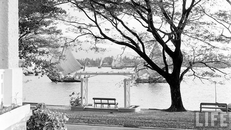
- Tourane: “Tourane” was the official name given to Da Nang by the French colonialists around 1860–1888, from the time France invaded Da Nang until the end of the colonial period in 1945. The name “Tourane” was mainly used by the French and officials working under them, while the local population continued to use the names Da Nang or Cửa Hàn, Đất Hàn.
As one of the major river mouths of Quang Nam (expanded southward), Da Nang’s seaport had been highly regarded for centuries, even during the flourishing period of Hoi An in the 17th century. We know of the famous painting by the Japanese Chaya family depicting the bustling trade in Hoi An. If the assumption is correct that the seaport illustrated in that painting was Da Nang, with the Marble Mountains and the Co Co River, then it is unsurprising to conclude that ocean-crossing vessels of large tonnage and advanced maritime technology from Japanese or Chinese merchants would have chosen Da Nang over Hoi An as their point of entry. The outstanding advantages of Da Nang Bay lay in its deep waters and high level of safety. In fact, from the 18th century onwards, Da Nang’s potential as a seaport increasingly demonstrated its superior importance to the region.
DANANG HISTORY (FROM 1835 TO 1995)
In 1835, when Emperor Minh Mang decreed: “Western ships are permitted to anchor only at Cua Han, and no other seaports are allowed for trade,” Da Nang became one of the largest commercial ports in Central Vietnam, a turning point in Da Nang History. From that point onward, instead of Dai Chiem Port as before, trade and diplomatic relations increasingly converged at Da Nang Seaport as the main hub of the central region. Owing to its strategic position and growing importance, Da Nang began to develop local handicraft industries such as ship repair, preliminary processing of agricultural and forestry products, and related commercial services.
In 1858, the French invasion of Vietnam began with an attack on Da Nang. This event is considered a defining chapter in Da Nang History, After the establishment of French Indochina, the French separated Da Nang from Quang Nam as a concession and renamed it Tourane. This administrative unit was placed under the direct authority of the Governor-General of Indochina rather than the Hue imperial court, even though the town was geographically located within Central Vietnam (Trung Kỳ).
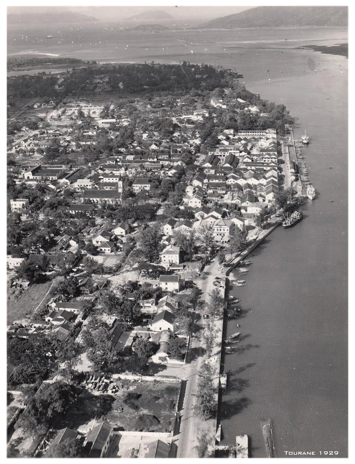
In the early 20th century, Tourane was developed by the French into a Western-style urban center. Investments were made in social infrastructure and production technology. Various industries and businesses emerged and expanded, including agriculture, handicrafts, export processing, ship repair, and service trade. Alongside Hai Phong and Saigon, Tourane became one of the country’s major commercial centers.
In March 1965, the United States landed in Da Nang and established a large joint military base there. In 1967, the Republic of Vietnam government designated Da Nang as a centrally governed city and set the goal of developing it into a political, military, and cultural center for Tactical Zones I and II.
In 1975, with the restoration of peace, Da Nang (as a city under Quang Nam–Da Nang Province) began addressing the severe consequences of the war. Despite many difficulties, the city’s recovery and development achieved significant results, especially during the period of Đổi Mới (Renovation) after 1986.
When the French launched their invasion of Vietnam, their first choice was Da Nang. The first Americans to land in Vietnam also chose this place. This was certainly not a mere coincidence of history, for although history, beyond its inevitabilities, always contains elements of chance, the importance and influence of Da Nang can be affirmed—stemming from its foremost position in Central Vietnam and its significance to the entire country.
Looking at the map, Da Nang clearly stands as the final point of a vast region. In front lies the sea; behind stretches the Central Highlands. On a larger scale, it connects to the entire Indochinese area, including Laos, Cambodia, parts of Thailand, and Myanmar. Today, the formation of the East–West Economic Corridor through the Lao Bao border gate, the expansion of National Highway 24B crossing the tri-border area of Ngoc Hoi, and, in the future, the potential construction of a direct western route through Ben Giang and across the Dak Ta Oc border gate linking Da Nang with the fertile Boloven Plateau—as suggested in recent promising research proposals—clearly place Da Nang in a pivotal position. It has been, and will continue to be, a key hub for trade and cultural exchange across the vast Mekong River region.
Da Nang is located at the midpoint of Vietnam, situated along the vital North–South transportation axis by road, rail, sea, and air. It serves as a major gateway for transportation across Central Vietnam and the Central Highlands, and it is the terminal point of the East–West Economic Corridor connecting Myanmar, Laos, Thailand, and Vietnam.
On November 6, 1996, at its 10th session, the 9th National Assembly passed a Resolution permitting Quang Nam–Da Nang Province to be separated into Quang Nam Province and Da Nang City, under direct central authority.
- Da Nang City was re-established under central authority, consisting of seven administrative districts: Hai Chau, Lien Chieu, Thanh Khe, Son Tra, Ngu Hanh Son, along with two rural districts, Hoa Vang and Hoang Sa. The city covered an area of 1,284.9 square kilometers, with a population of 663,115 people, comprising 47 wards and communes.
- Meanwhile, Quang Nam Province consisted of 14 districts: Giang (now Nam Giang District), Hien (now Dong Giang and Tay Giang Districts), Dai Loc, Phuoc Son, Duy Xuyen, Dien Ban, Que Son, Thang Binh, Hiep Duc, Tien Phuoc, Tra My (now Bac Tra My and Nam Tra My Districts), Nui Thanh, along with two towns: Tam Ky Town (now Tam Ky City, the provincial capital, and Phu Ninh District) and Hoi An Town (now Hoi An City).
On January 1, 1997, the historic separation of Quang Nam–Da Nang into two centrally governed administrative units—Quang Nam Province and Da Nang City—marked the beginning of a new era of development for the Party Committees and the people of both localities.

The newly established Da Nang City covers a natural area of 11,859.59 square kilometers and has a population of 3,065,628 people.
After nearly 30 years of construction and development, on June 12, 2025, the National Assembly officially adopted a Resolution on the reorganization of provincial-level administrative units in 2025. Accordingly, the entire natural area and population of the former Da Nang City and Quang Nam Province were consolidated to establish the new Da Nang City.
The newly established Da Nang City covers a natural area of 11,859.59 square kilometers with a population of 3,065,628 people. It borders Hue City to the north, Quang Ngai Province to the south, the Lao People’s Democratic Republic to the west, and the East Sea to the east. Da Nang is the largest in area among the six centrally governed cities.
The political and administrative center is located in Hai Chau Ward, Da Nang City.
Da Nang City comprises 94 commune-level administrative units, including 23 wards, 70 communes, and one special zone, Hoang Sa. The political and administrative center is located in Hai Chau Ward, Da Nang City.
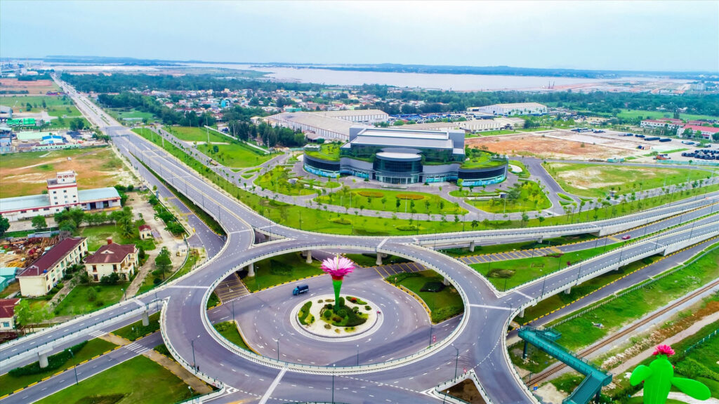
After the merger, Da Nang City possesses one of the most comprehensive and diverse transportation and logistics infrastructures in the country. This includes two airports: Da Nang International Airport—the gateway to the Central Coast—and Chu Lai Airport—the logistics and industrial hub of the southern area.
Da Nang also possesses a system of deep-water seaports, including Tien Sa Port, Lien Chieu Port, Chu Lai Port, Ky Ha Port, and Truong Hai Port, forming a logistics axis that connects the North Central to the South Central regions and serves as the starting point of the East–West economic corridors.
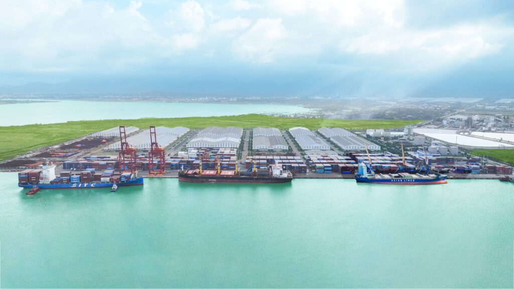
Chu Lai Port
The railway system, National Highway 1, the Da Nang–Quang Ngai Expressway, and the coastal route provide seamless connections between urban, industrial, and rural areas. Among these, the Da Nang–Quang Ngai Expressway is one of the most important transport routes, reducing travel time, facilitating trade, and enabling rapid connectivity between key economic zones in Central Vietnam.
As the economic center of the Central–Central Highlands region, Da Nang is experiencing strong growth in industry, high-tech industry, and information technology, with industrial zones operating stably. Notably, these include the Da Nang Hi-Tech Park, the Chu Lai Open Economic Zone, and several industrial clusters soon to be put into operation.
Chu Lai Open Economic Zone
The fields of semiconductor technology and artificial intelligence are also opening new development directions for the city. Da Nang has been and continues to implement numerous action programs, promotional activities, investment attraction initiatives, and workforce training in technology, semiconductors, and artificial intelligence.
The development of the Da Nang Free Trade Zone linked to the International Financial Center… contributes to enhancing Vietnam’s position regionally and globally, while opening a new era in Da Nang History.
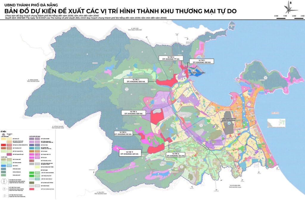
The development of the Da Nang Free Trade Zone will be linked to the International Financial Center of Vietnam, located in Da Nang.
According to the orientation, the development of the Da Nang Free Trade Zone will be integrated with the International Financial Center of Vietnam, located in Da Nang, offering international financial services, Fintech-related services, digital banking, and financial products linked to digital assets, tokenized blockchain assets, and artificial intelligence. This will foster the creation of a modern, intelligent, and highly competitive economic ecosystem with wide-reaching influence, contributing to enhancing Vietnam’s position in the region and globally in the context of globalization.
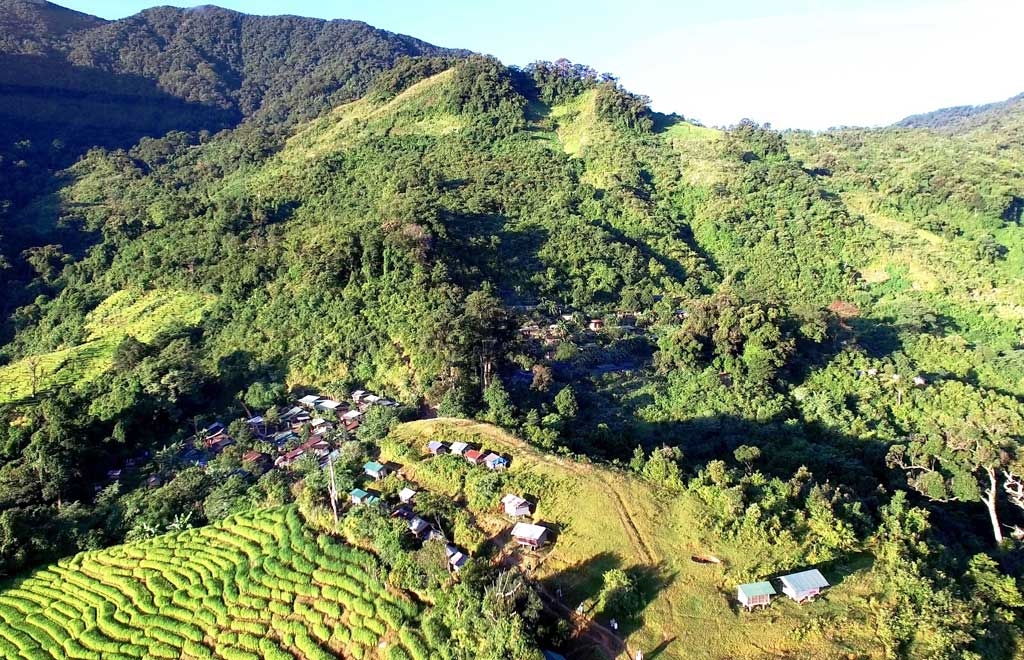
Ngoc Linh Peak – regarded as the capital of Ngoc Linh ginseng.
Contributing to the economic development of the western part of the city, the Ngoc Linh ginseng capital, located at an altitude of over 1,600 meters, is home to one of the world’s rarest ginseng varieties. The development of Ngoc Linh ginseng is not only aimed at generating wealth but is also closely linked to forest protection, biodiversity conservation, and climate change adaptation.
Da Nang City also possesses distinctive strengths in the field of tourism and services. Mentioning Da Nang inevitably calls to mind its outstanding and unique tangible cultural heritages that attract visitors.
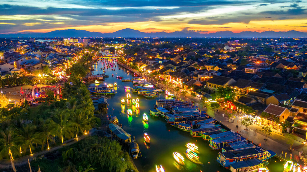
Da Nang City is the only place that simultaneously possesses two World Cultural Heritage Sites: Hoi An Ancient Town and My Son Sanctuary.
Da Nang City is the only place that simultaneously possesses two World Cultural Heritage Sites—Hoi An Ancient Town and My Son Sanctuary—and one World Biosphere Reserve, Cu Lao Cham, a unique highlight in Da Nang History of cultural and ecological preservation.
In addition, the city is home to two nationally designated special relics (Dien Hai Citadel and the Marble Mountains), seven national intangible cultural heritages, and six recognized national treasures, along with 72 national relics, 351 city-level relics, and hundreds of notable folk festivals. It also preserves many other valuable intangible heritages such as: Tuồng (classical drama), The Art of Bài Chòi in Central Vietnam, Ho Ba Trao (traditional rowing chants) in music; culinary arts; folk knowledge; and traditional craft villages.
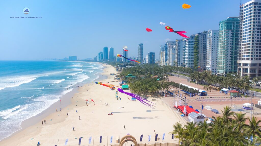
Da Nang is home to My Khe Beach—one of the most beautiful beaches on the planet.
Da Nang also boasts many beautiful beaches such as My Khe, Non Nuoc, Cua Dai, An Bang, Ha My, and Tam Thanh; as well as destinations like Sun World Ba Na Hills, Da Nang Downtown, Da Nang Mikazuki Japanese Resorts & Spa, Son Tra Peninsula, Bay Mau Coconut Forest, and VinWonders Nam Hoi An.
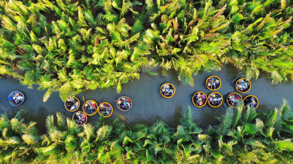
Along with its high-end resorts, hotel systems, and seaside resorts stretching along the coastline, the city offers visitors a wide variety of choices. Not far from Cu Lao Cham—the emerald island in the East Sea and a World Biosphere Reserve—lies the Hoang Sa Special Zone, a sacred symbol of Vietnam’s maritime sovereignty, under the jurisdiction of Da Nang City.
Bay Mau Coconut Forest
Known not only as a young and dynamic city, Da Nang also strives to preserve and promote the values of its centuries-old traditional craft villages. These vibrant craft traditions form a living chapter in Da Nang History, blending heritage with modern identity: Nam Ô Traditional Fish Sauce Making Village, rich with the flavor of the sea; Tuy Loan rice paper, a simple yet rustic local specialty; Phuoc Kieu bronze casting, renowned for its intricate molds; and Kim Bong carpentry, marked by finely carved wooden products. Together, these crafts weave a vibrant and lively picture of traditional villages within the heart of a modern city.
Investing in healthcare and education to ensure a high quality of life for its residents is an important objective in the city’s development efforts.
Da Nang’s healthcare sector has advanced significantly, continuously developing and integrating deeply with the aim of becoming the core of a specialized medical center, providing high-quality diagnosis and treatment for the Central–Central Highlands region and the entire country, while also developing medical tourism products. Through specialized training programs, as well as domestic and international cooperation, many advanced and modern medical techniques have been successfully applied and transferred to the city’s major hospitals, such as Da Nang General Hospital, the Obstetrics and Pediatrics Hospital, and the Oncology Hospital. These efforts have reduced the need to transfer patients to central hospitals or abroad and have met the healthcare demands of the city’s residents and the region.
The city is also focusing its resources on investing in education, from building schools to refining policies, with the goal of enhancing the quality of comprehensive education. Da Nang is among the few localities with a large number of universities (more than 20 universities and higher education institutions) and a substantial student population. This is a major advantage and a unique characteristic that enables Da Nang to develop into a center for high-quality human resource training—an endeavor of strategic importance not only for the city’s development requirements but also for the nation in the “era of national advancement.”
References on Da Nang History
- Da Nang City Portal – danang.gov.vn
- Da Nang Overview – Da Nang Publishing House, March 2010
- A Brief History of Da Nang: 700 Years (1306–2006) – Da Nang Publishing House – Authors: Lê Duy Anh, Lê Hoàng Vinh
- Image sources: Internet; Photographer: Kim Liên
DANANG HISTORY – DANANG TOURISM PROMOTION CENTER