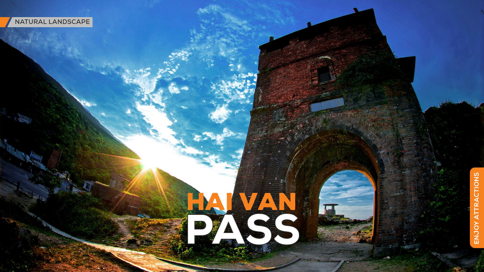
The Hai Van Pass, also known as Hai Van Mountain, derives its name from the Vietnamese words for “clouds and sea.” It represents the final peak of the imposing Truong Son Range, extending into the expansive ocean. Reaching a height of 1,450 meters, the summit of Hai Van Pass is often enveloped in clouds, while its lower slopes blend into the limitless sea.

OVERVIEW:
The Hai Van Pass, as eloquently described by poet Ngô Thì Chí in the 18th century, stands as a majestic marvel. The mountain’s dominance over the Ngan River, with its rugged cliffs and abundant foliage providing shade, creates a breathtaking landscape. The crashing waves and cascading streams evoke a sense of awe and wonder best experienced by those who traversed the pass on foot along the ancient trails.
Geographically and geologically, it is a significant boundary in Vietnam’s natural landscape. To the north, you’ll find karstic limestone scenery with fascinating caves and temperate monsoon forests, while the south boasts tropical equatorial forests. At the summit, the weather undergoes dramatic changes throughout the day, showcasing characteristics of all four seasons. Positioned as the geographical boundary between the North and the South, it has been recognized as a strategically important position on the North-South axis by Vietnamese authorities.
Despite the challenges posed by dense forests, steep slopes, deep ravines teeming with predators, and the looming threat of bandits, humans have been crossing this mountain barrier for centuries. The enduring impression of fear among travelers passing through Hai Van is encapsulated in a folk verse: “On foot, one fears the Hai Van; by sea, one dreads the giant waves at Bat Cave.”
In ancient times, there were three routes across the Hai Van: the upper, middle, and lower. The lower route was a coastal path, while the upper and middle routes traversed the mountains. Today, there are two routes across the Hai Van Pass: the Hai Van Tunnel and the Hai Van Pass road.
Hai Van Pass Tunnel:
- Opening Hours: The tunnel is open every day, but it is closed from 3 a.m. to 4 a.m. daily for cleaning, maintenance, and repairs.
- Ticket Prices: Motorbike transportation costs range from 25,000 to 30,000 VND per trip, per vehicle. Pedestrians are charged 8,000 VND per person per trip.
Note: Because the tunnel passes through a mountain, tourists cannot enjoy the beautiful scenery or visit some famous sites on the Hai Van Pass.
Hai Van Pass Road:
- Opening Hours: Every day.
- Ticket Price: No fee.
Note: You should choose this route if you want to explore and fully experience the feeling of conquering the Hai Van Pass.
THE GREATEST FRONTIER MILITARY POST
Following the country’s unification in the early 19th century, the Nguyen dynasty selected Hue as the capital, positioning the Hai Van Pass as the entryway to the capital. During the reign of Minh Mang, the pass road was constructed, and a series of military fortifications known as Hai Van Quan were established. Although much of the structure has been dismantled, two primary arches and a short wall section remain. The arch facing Thua Thien features a stone plaque inscribed with the character “Hai Van Quan,” measuring 6.16m in height, 7.7m in width, and 6.37m in thickness. On the arch facing Quang Nam, there is an inscription of six characters, “Thiên hạ đệ nhất hùng quan,” translating to “The Greatest Frontier Military Post,” with dimensions of 5.2m in height, 7.9m in width, and 4.75m in thickness.
After capturing Central Vietnam, the French army’s commander-in-chief, General De Courcy, ordered the immediate opening of a strategic road through the Hai Van Pass to connect Hue with Da Nang. The French engineering corps compelled laborers from two provinces to build the road starting in 1886. This 20 km-long road has undergone over a century of modifications, expansions, and upgrades but remains in its original position.
In the early 20th century, a railway line 100m above sea level was constructed through the pass. It is 21km long, runs along the mountain range, and passes through 7 tunnels, totaling 3,290m, the longest of which is the Sen Tunnel at 562m.
On August 27, 2000, a groundbreaking ceremony was held to open a 6,274m-long road tunnel through the Hai Van Pass, shortening the pass route by one-third. Vehicles no longer need to traverse the winding and dangerous mountain passes. At 1:10 am on October 28, 2003, Southeast Asia’s largest and most modern tunnel road was officially opened.
It is the most majestic scenic spot in Vietnam and witnessed numerous heroic achievements in the nation’s nation-building and defense efforts over many centuries, especially the battles fought here during the two resistance wars against the French and the Americans (1946-1975).
ACCESS:
- It is 20km from Da Nang City and 80km from Hue City. For convenience, you can travel to Da Nang City using various means such as airplane, train, or bus, and then rent a vehicle to reach Hai Van Pass.
- Car: Traveling by car on the mountain pass road is limited as most cars now opt for the tunnel route through Hai Van Pass.
- Motorbike: This vehicle is the best choice for fully experiencing the Hai Van Pass. Traveling on a motorbike, you can easily stop at various locations along the pass to rest, admire the scenery, take photos, and relax. If you depart from Da Nang, you will arrive at the foot of Hai Van Pass after about 1 hour.
TRAVEL TIPS:
- Being at the mountain pass at sunrise or sunset can offer stunning photo opportunities and the most enchanting atmosphere of the day.
- Climbing up to Hai Van Quan with friends to enjoy coffee bought at the top of the pass is an experience worth trying.
- The Arch Bridge – Don Ca is an exciting attraction.
References:
1. Da Nang City’s official website: danang.gov.vn
DANANG CENTER FOR TOURISM PROMOTION